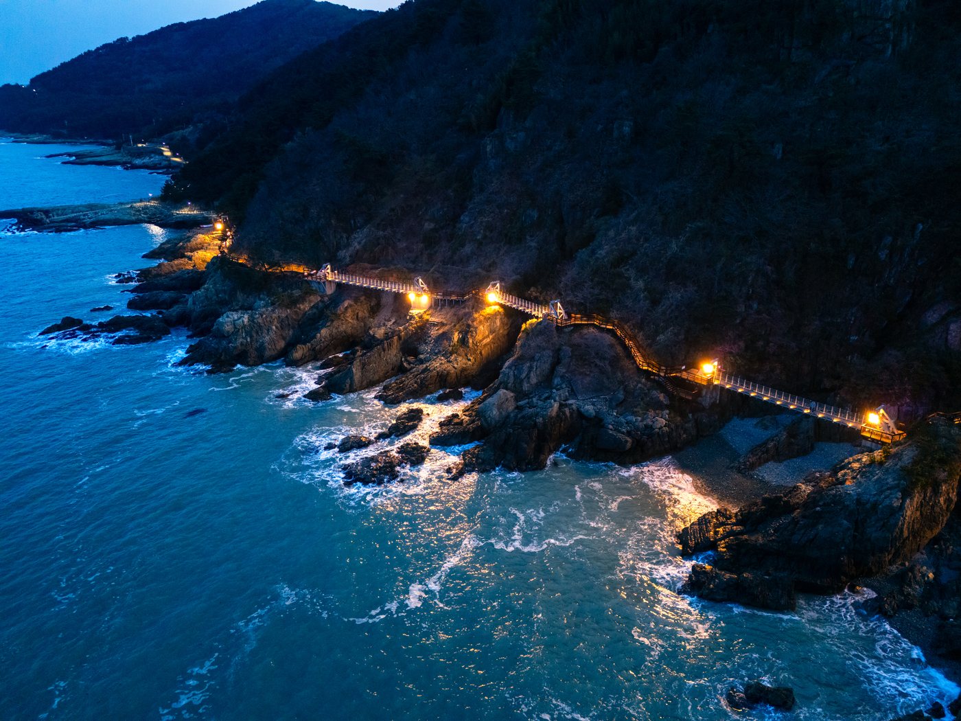
Igidae at night — lights glow along the bridge and boardwalk between the cliffs.
A walking trail along sea cliffs with views of Gwangan Bridge and Haeundae. It was a military zone for decades and closed to the public, and the volcanic rock formed 80 million years ago is still there.
As of October 7, 2026 — please check opening hours, closures and prices before you go.
Igidae at night — lights glow along the bridge and boardwalk between the cliffs.
Igidae is a stretch of sea cliffs on the shore of Yongho-dong, Nam-gu, Busan. The trail along it is the Igidae Coastal Walk, part of the Busan National Geopark. There is no admission fee, and it is open year-round.
| Item | Details |
|---|---|
| Location | Yongho-dong, Nam-gu, Busan (Oryukdo Sunrise Park to Dongsaengmal) |
| Cost | Free, open year-round |
| Walking time | About 2–2.5 hours one way (about 4.7 km) |
| Difficulty | Moderate — there are ups and downs and rocky sections |
| Best seasons | Spring and autumn (per the Korea Tourism Organization) |
Where does the name come from? Igidae (二妓臺) means "the place of two gisaeng" — gisaeng were professional female entertainers of the Joseon era. The Dongnae Yeongji, a local gazetteer written in 1850, says the spot was called Igidae because "two gisaeng are buried above." Another story says a Gyeongsang Left Naval Commander (the regional navy chief) enjoyed feasts here with two gisaeng. A different account says that during the Imjin War (the Japanese invasion), a righteous gisaeng threw herself into the sea holding a drunken Japanese general, so the place was first called Uigidae (義妓臺, "the place of the righteous gisaeng"), which later became Igidae. Which version is right has never been settled.
A place people could not enter. During the Japanese colonial period, Japanese troops are said to have built coastal guard barracks and positions along this shore. Afterward it stayed a restricted military zone for a long time, closed to civilians, and it only opened to the public in 1993. There was also a copper mine here, worked during the colonial period; it is said to run 550 m horizontally and 380 m vertically.
Because access was restricted for so long, the coast saw less development, and several guides say the cliffs and rocky terrain remain relatively intact.
The rock at Igidae formed from volcanic activity about 80 million years ago, in the late Cretaceous. You can see layers of rock built up from lava and volcanic ash, and some guides say traces of at least three eruptions can be seen here. Over a very long time, waves carved this rock into the cliffs you see today.
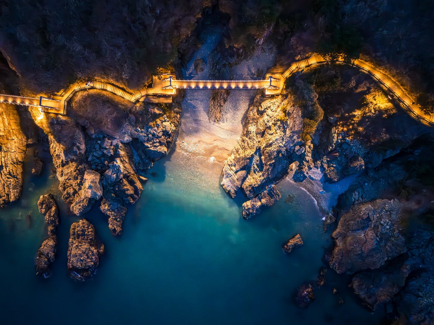
Igidae from above — a bridge and boardwalk link the rock cliffs.
| What to see | What it is |
|---|---|
| Sea caves and sea cliffs | Caves and sheer drops that waves carved out of the weaker parts of the cliff |
| Potholes | Round holes worn into the rock as pebbles and sand spin in the waves |
| Nongbawi | A rock stacked in layers like a nong, a traditional Korean wardrobe |
| Chimabawi | A rock whose cliff face looks like a hanging skirt (chima) |
| Batgolsae | Where a rock dike (a vein of volcanic rock that cut through the older rock) has eroded into furrows like a ploughed field |
| Copper mine site | Traces of the copper mine worked during the colonial period |
| Cloud bridge (Gureumdari) | A bridge across the cliffs where you can look down at the waves |
The seasons. Guides describe flowers in spring, sea breezes in summer, silver grass and sunsets in autumn, and clear views in winter. Some visitors report yellow daffodils at Oryukdo Sunrise Park around mid-March. The wind off the sea is often strong, so bring a light jacket.
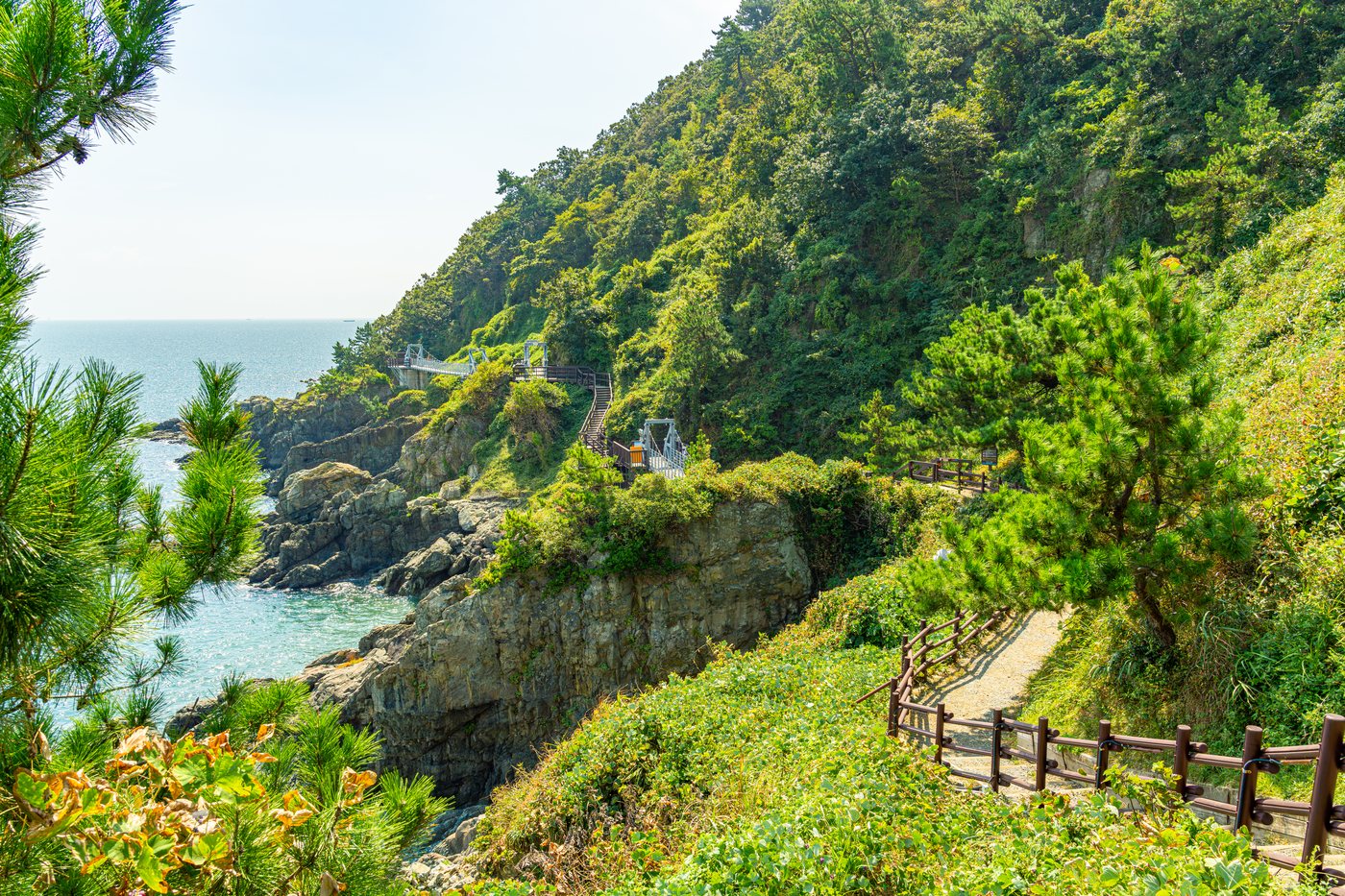
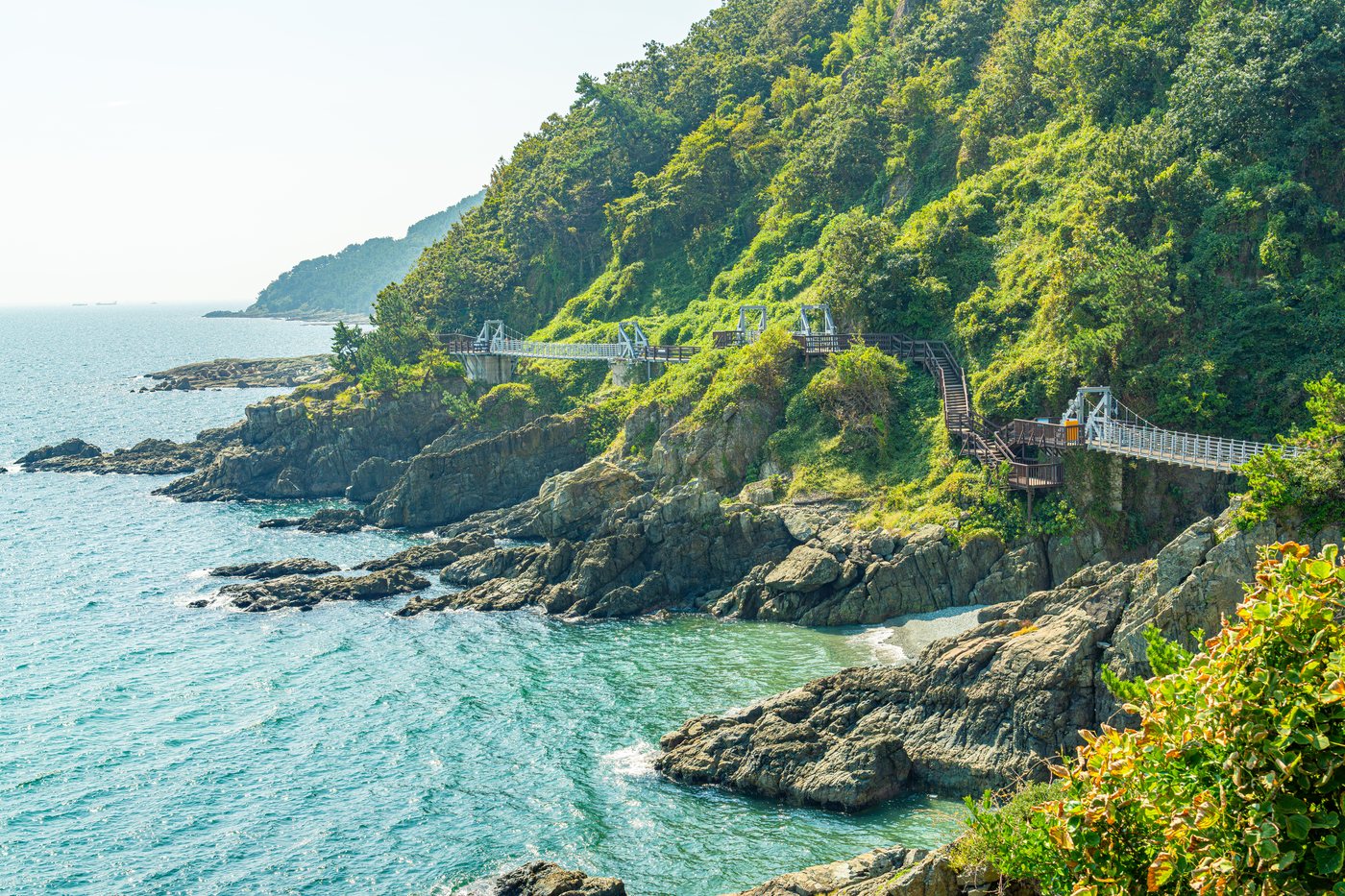
The trail by day — boardwalks and bridges run between forest, rock and sea.
This is not a loop but a one-way trail. The Korea Tourism Organization describes it in the order below; you can walk it in reverse too.
| Order | Section | Good to know |
|---|---|---|
| 1 | Dongsaengmal Observatory | The name is said to mean "the eastern end of the mountain." A viewpoint with wide views toward Gwangan Bridge and Haeundae |
| 2 | Eoulmadang (어울마당) | A wide open plaza. Restrooms and a kiosk are listed |
| 3 | Nongbawi | A cluster of rock formations |
| 4 | Oryukdo Sunrise Park | The end of the trail. The Oryukdo Skywalk is here |
There are not many facilities along the way, so bring water. Sneakers are recommended.
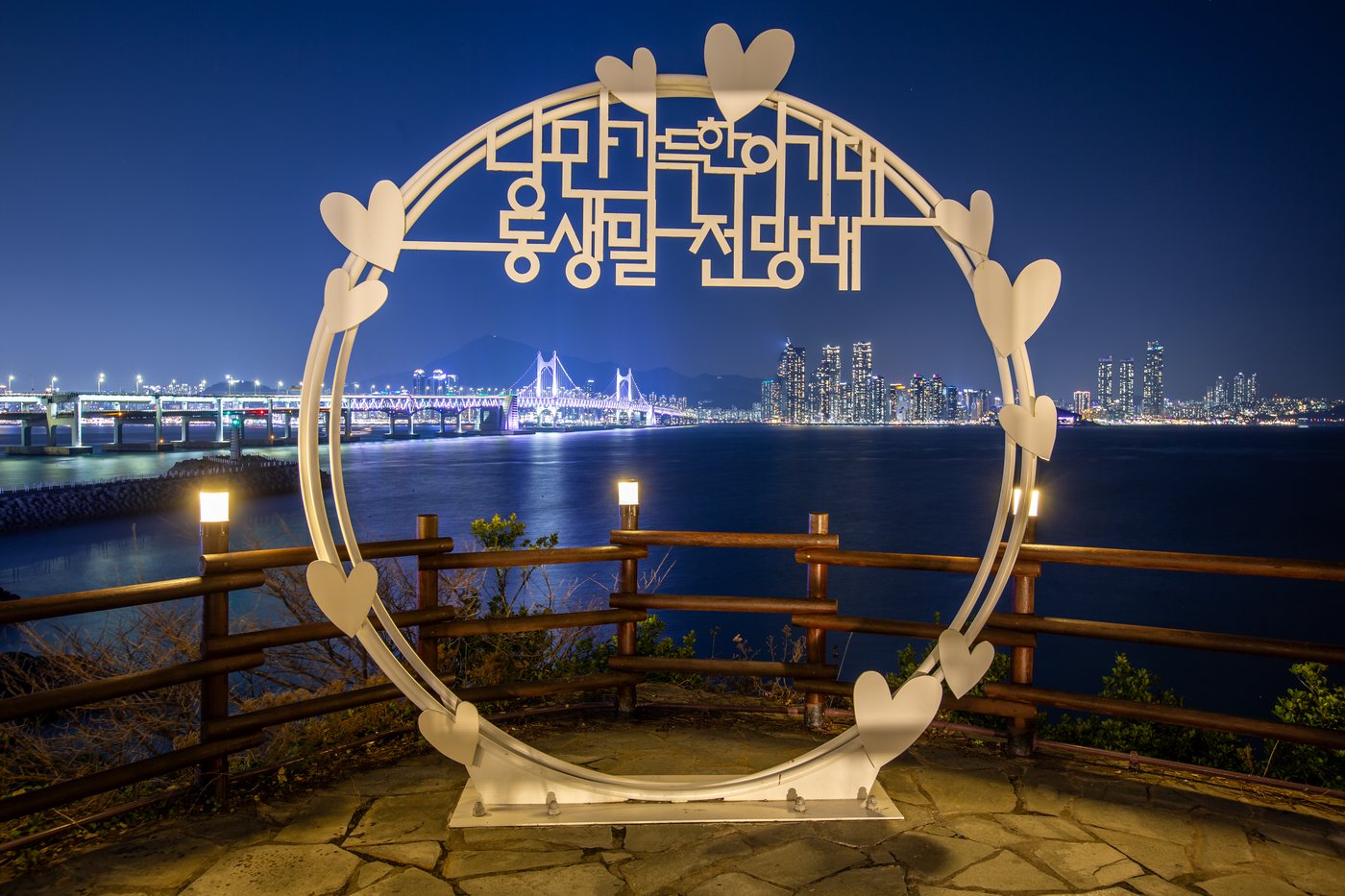
Dongsaengmal Observatory — Gwangan Bridge and the Haeundae night view behind the circular photo spot.
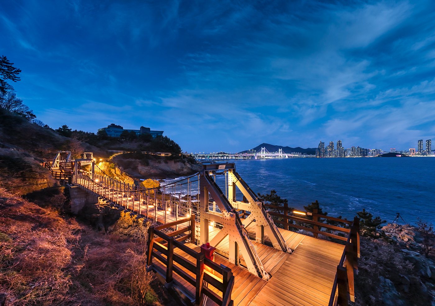
The cloud bridge at night — on the lit stretch you can see Gwangan Bridge and the Haeundae skyline.
About 1.26 km of the trail is lit, from sunset until 10 p.m. (since January 2024). Outside the lit section it is dark, so after dark stick to the safe stretches and do not push it.
The Skywalk is open daily 09:00–18:00. If you plan to walk late in the evening, see the Skywalk first, in daylight. You have to wear shoe covers over your shoes, and it may close in heavy rain or wind.
A U-shaped glass bridge at the end of Oryukdo Sunrise Park. It juts out about 15 m from a 35 m-high cliff, with the sea visible under your feet. This is known as the point where the East Sea and the South Sea meet, so the Haeparang Trail, which runs along the east coast, starts here, and the Namparang Trail, which follows the south coast, ends here. Oryukdo are six rocky islets just offshore. The name means "five or six islands": the island nearest the shore, Usakdo, looks like one island at low tide and like two (Bangpaeseom and Solseom) at high tide, so people counted either five or six. An old record also says it looks like five peaks from some spots and six from others.
| Item | Details |
|---|---|
| Hours | Daily 09:00–18:00 |
| Cost | Free |
The six islands of Oryukdo (in order from the shore)
| Island | Meaning of the name |
|---|---|
| Bangpaeseom (Shield Island) | Named because it shields the shore from strong wind and waves |
| Solseom (Pine Island) | A pine tree grows on top |
| Suriseom (Eagle Island) | Eagles are said to have gathered there |
| Songgotseom (Awl Island) | Small and pointed, like an awl |
| Gulseom (Cave Island) | The biggest of the six, and it has a cave |
| Deungdaeseom (Lighthouse Island) | It has a lighthouse. The only inhabited island, once also called Batseom (Field Island) |
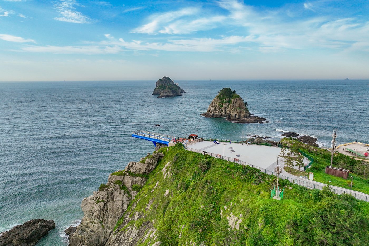
Oryukdo Sunrise Park — the blue Skywalk sits at the cliff edge, and Oryukdo rises from the sea.
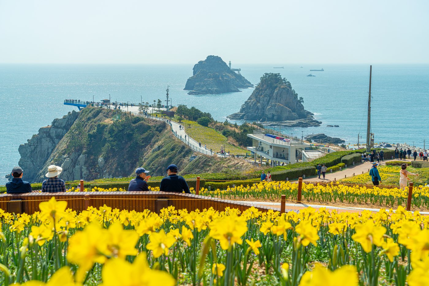
Spring daffodils — beyond the flower bed you can see the path to the Skywalk and Oryukdo.
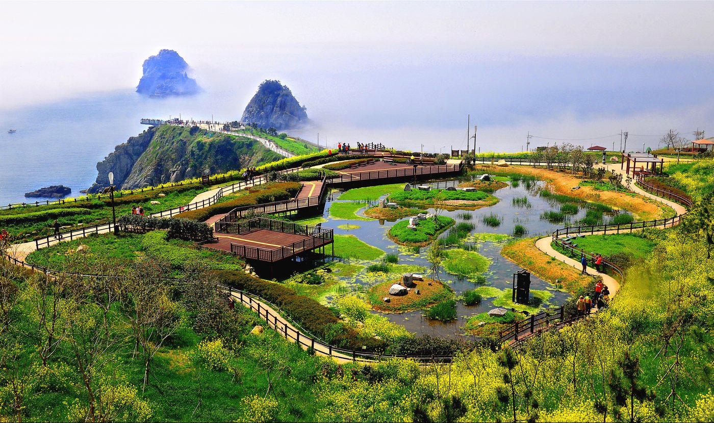
Pond and boardwalk in the park — the Skywalk and Oryukdo are visible in the distance.
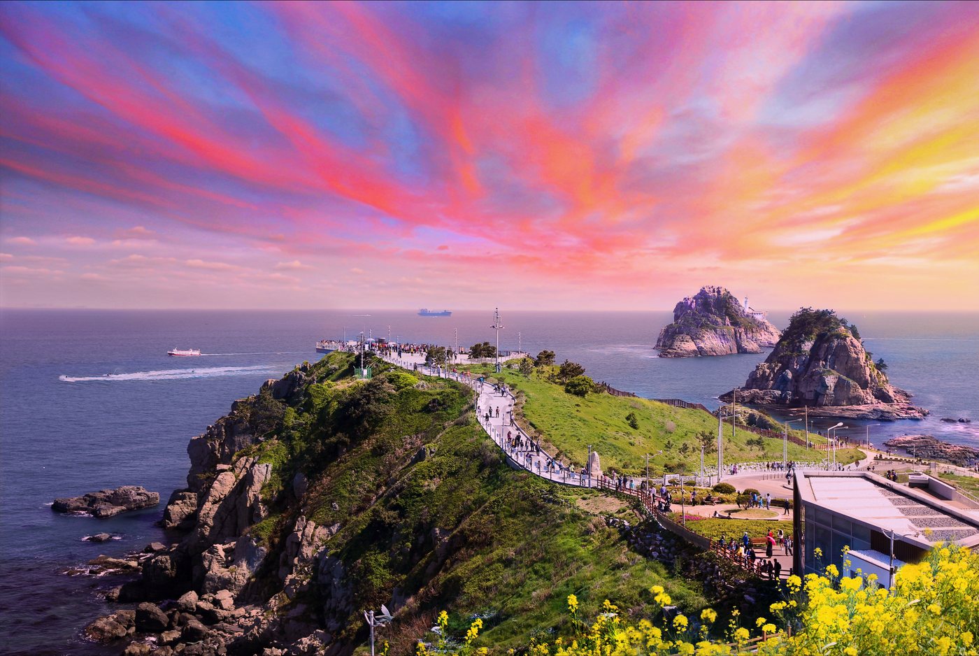
The path to the Skywalk — the Skywalk is at the end, and Oryukdo is in the sea on the right.
You cannot walk to Igidae from a subway station. Take Subway Line 2 to Gyeongseong Univ.·Pukyong National Univ. Station, exit 5, then a bus. The bus depends on where you are headed. Tap the directions button in each card below to open the route from the station in a map app.
Address — San 1, Yongho-dong, Nam-gu, Busan
How to get there — Exit 5, turn around and bear right → at the Gyeongseong Univ. Entrance (경성대학교입구) stop, take village bus Nam-gu 2 (남구2) → get off at Bunpo High School (분포고등학교) and walk about 10 minutes to the left
Time and fare — About 30 minutes, about KRW 1,500
Address — 137 Oryukdo-ro, Nam-gu, Busan
How to get there — Exit 5, turn around and bear right → at the Gyeongseong Univ. Entrance (경성대학교입구) stop, take bus 24 or 27 → get off at the Oryukdo Skywalk (오륙도스카이워크) stop
Time and fare — About 25 minutes, about KRW 1,600
If you drive, parking costs KRW 300 per 10 minutes, with a daily maximum of KRW 8,000 (per Naver Map, October 8, 2026).
Instead of walking, you can look up at the Igidae cliffs and Oryukdo from a boat. The Oryukdo Marine Tour from Haeundae Cruise (Mipo Pier, Haeundae) is described as passing Dongbaekseom → Gwangan Bridge → Igidae → Oryukdo. In the evening there is also a Gwangan Bridge Night Tour.
| Item | Oryukdo Marine Tour | Gwangan Bridge Night Tour |
|---|---|---|
| Departs | Daily 13:00–sunset | Daily sunset–20:00 |
| Duration | About 70 min round trip | About 50 min round trip |
| Fare (special discount) | Adult 25,000 Child 14,000 | Adult 28,000 Child 16,000 |
Fares are in KRW. Boats depart as needed, and the schedule can change from month to month, so check departure times at the pier on the day you go.
The fares in the table are for booking on Naver Map. Naver Map's online payment will probably not work for overseas visitors, so you may have to buy tickets in person at the ticket counter. Buying on the spot costs KRW 31,000 for adults and KRW 18,000 for children on the Oryukdo Marine Tour (per Naver Map, October 8, 2026). Leave some extra time in case you have to buy in person.
Address — 33-1 Dalmaji-gil 62beon-gil, Haeundae-gu, Busan
On-site inquiries — 051-742-2525
If you have time left, these are easy to add on the same day. The two are right next to each other, so you can see both in one go.
| Place | What it is |
|---|---|
| UN Memorial Cemetery | A memorial park honoring the UN soldiers who died in the Korean War. Daeyeon Arboretum is inside the park |
| Busan Museum | A museum where you can learn the history of Busan |
Parts of the trail may be closed for maintenance or safety checks. Before you visit, check with the Nam-gu Office Parks and Greenery Division (051-607-4544) or the Igidae Park management office (051-607-6398).
If it is your first time, start at Oryukdo Sunrise Park and see the Skywalk first, then walk in toward Eoulmadang if you have time. You do not have to walk the whole way. You can also use only half your energy and turn back, keeping the return trip in mind.
| Time | Plan | Good when |
|---|---|---|
| About 1 hour | Bus to Oryukdo Sunrise Park → Skywalk → a short stretch of the trail | You are short on time |
| About 3 hours | Start at Oryukdo Sunrise Park, walk to Eoulmadang and back | You want to see only as much as is comfortable to walk |
| About 4–5 hours | Skywalk → walk the whole trail one way → transfer onward | You want to walk Igidae properly |
| Half day | Haeundae Cruise Oryukdo Marine Tour → Oryukdo Skywalk | You do not feel like walking but still want to see it from the sea |
Times are K-Rambles' rough estimates. They vary with walking speed and photo stops.
Photo credit — Busan Tourism Archive (KOGL Type 1 (Korea Open Government License)).